
Table of Contents
The Agenda
Decision, decision
This is the day that i decided to go online and update my mom on my condition, so i woke up at 5 and activate my wifi connection. Bought it at reception for 23 USD (i know it’s not cheap).Well, so i spent the first hour in the morning getting online and updated my social media status, also free up some space in my phone due to whatsapp overmessages for the last 5 days i went offline.
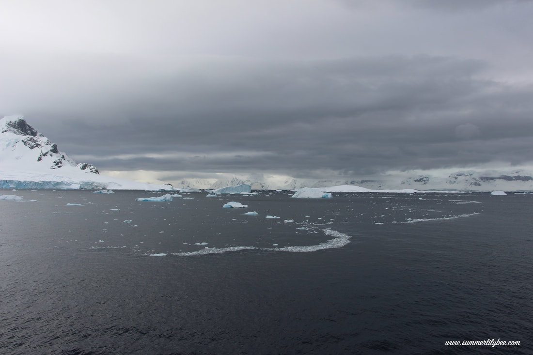
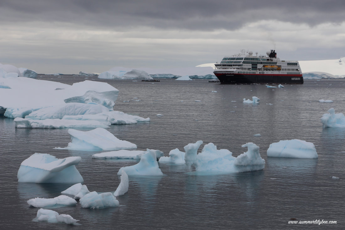
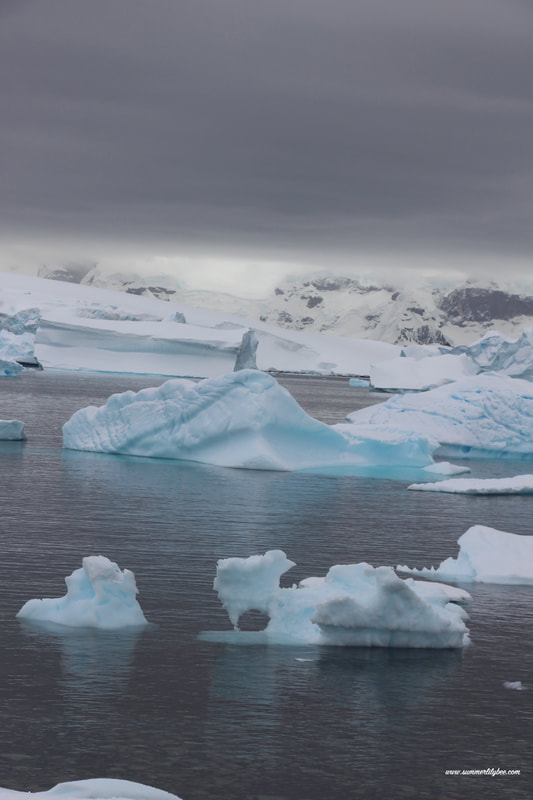
And then i hurried up myself for breakfast and went outside in deck-6 to get some nice pictures of floating ices around the boat. It was nice to get icebergs for a change. It was quite a view.
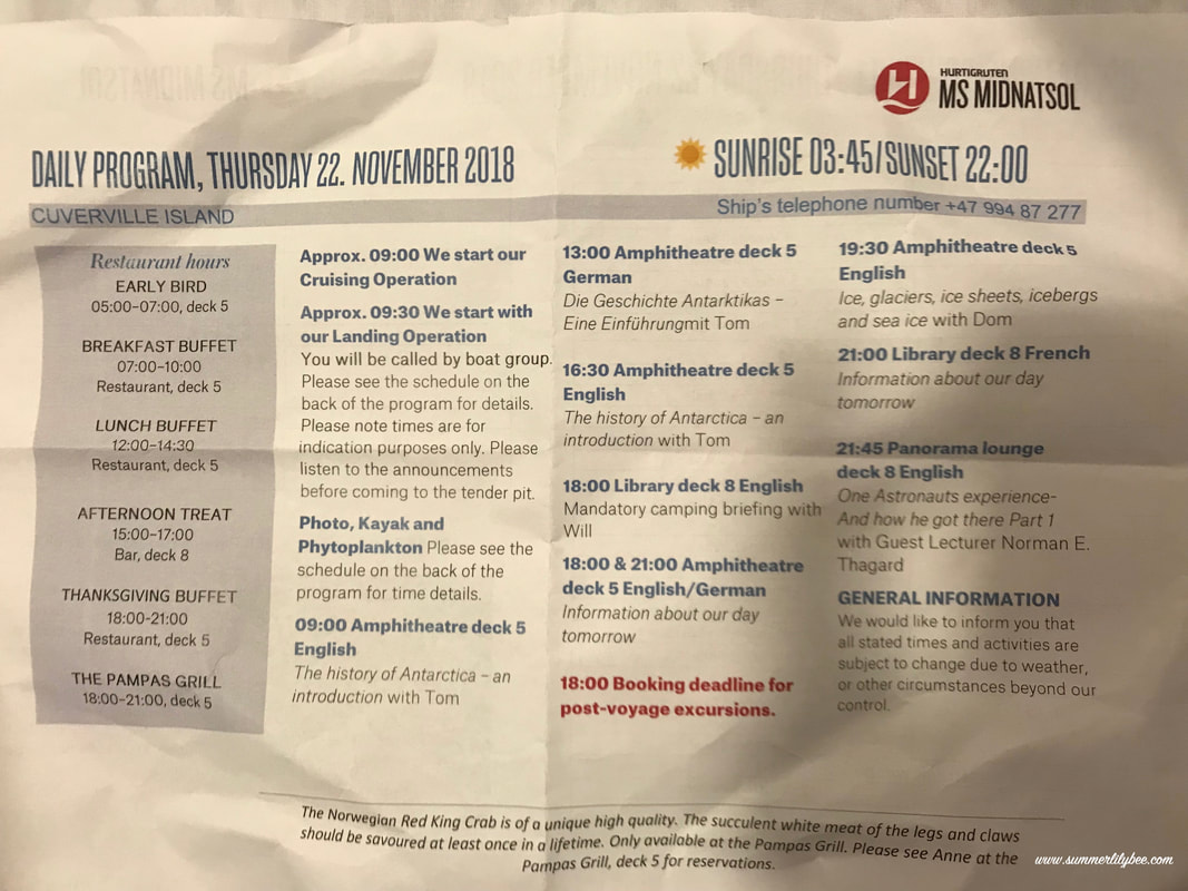
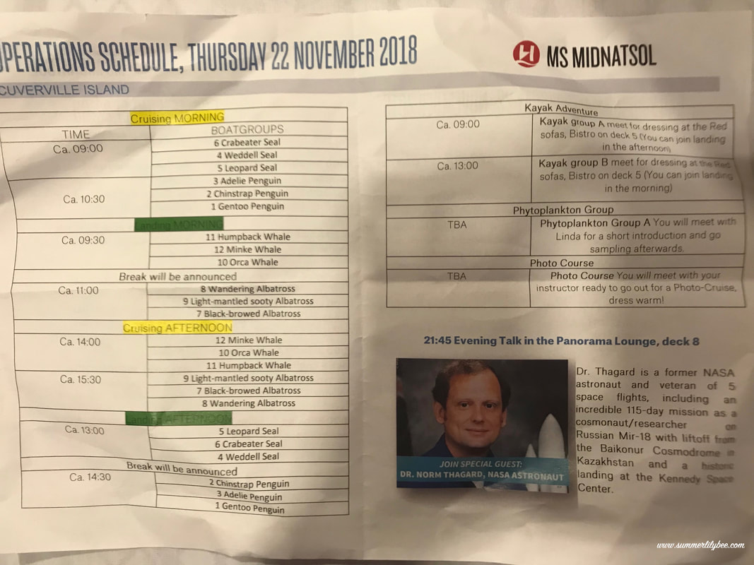
Last night i went to bed happy knowing that today my group (group #11, the humpback whale) will have the first landing time at 9 am!! Hurray!! They somehow rotate the group so every group has the chance to get an early land.
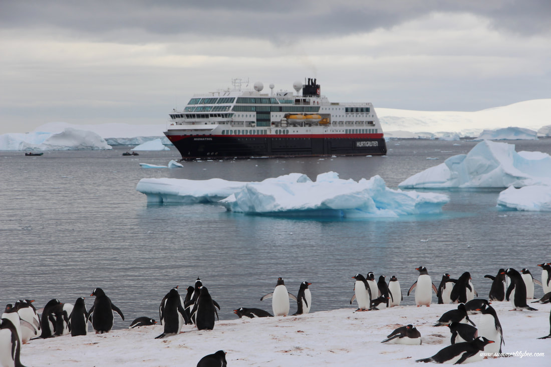
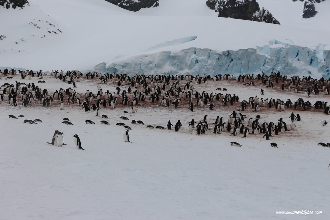
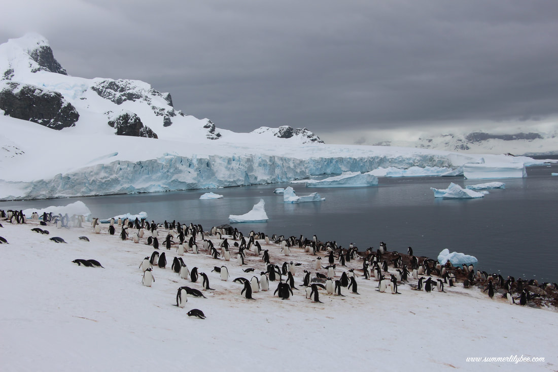
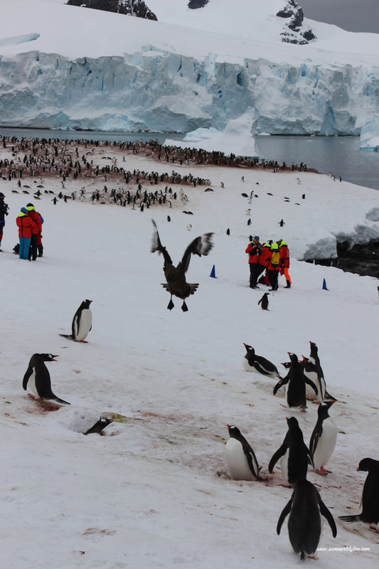
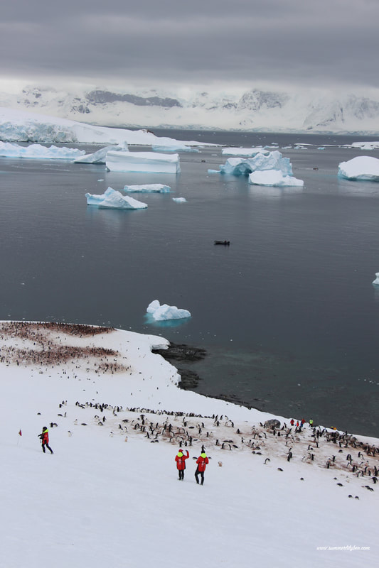
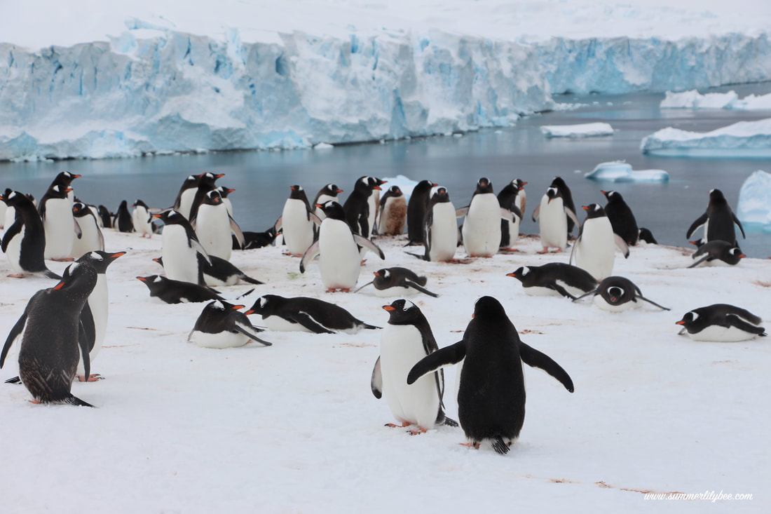
This time, the landing will be quite far from the ship, since there were so many iceberg (another hurray) on the way. Soon as i hopped on the rubber boat, i was so excited. As we got closer to the Cuverville island, thousands of Gentoo Penguins colonies came into view. I didn’t think i’d seen so many penguins in my life before. I was extremely excited.
The landing and the hike
|
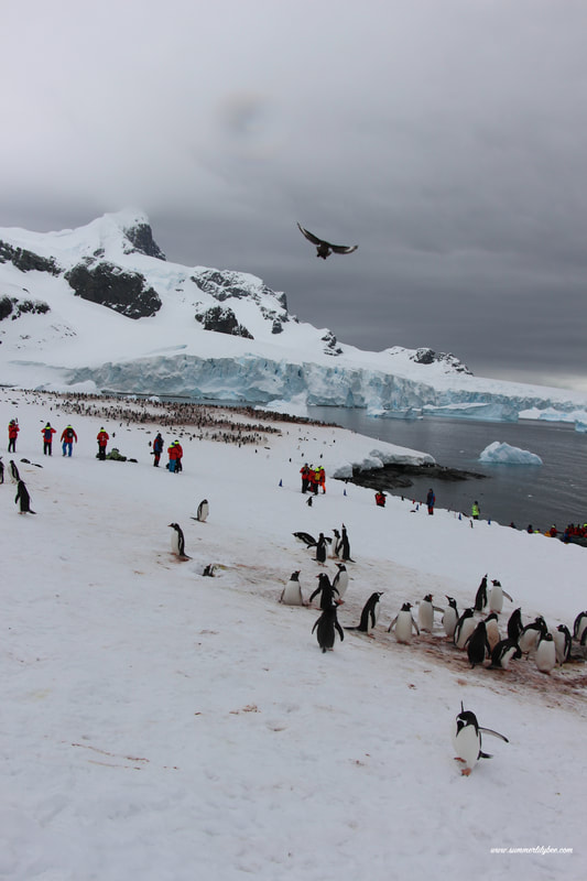
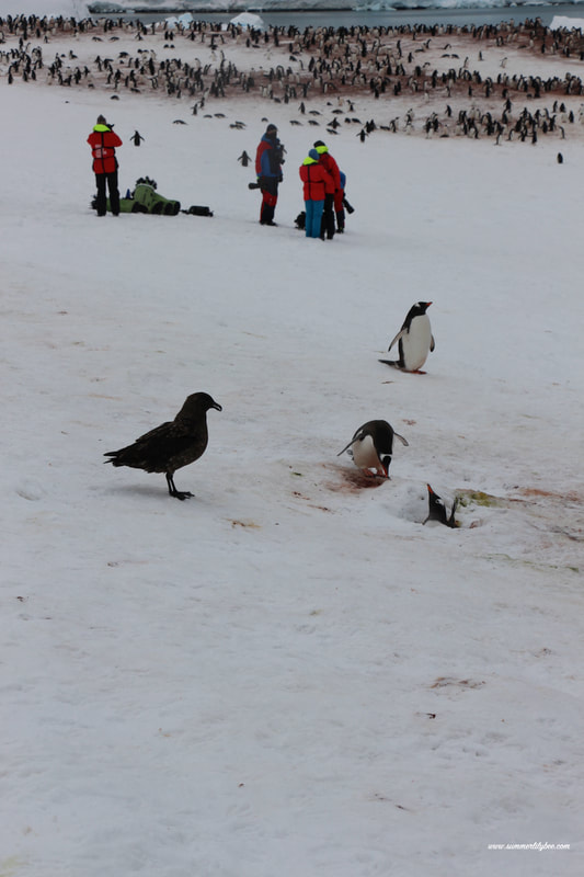
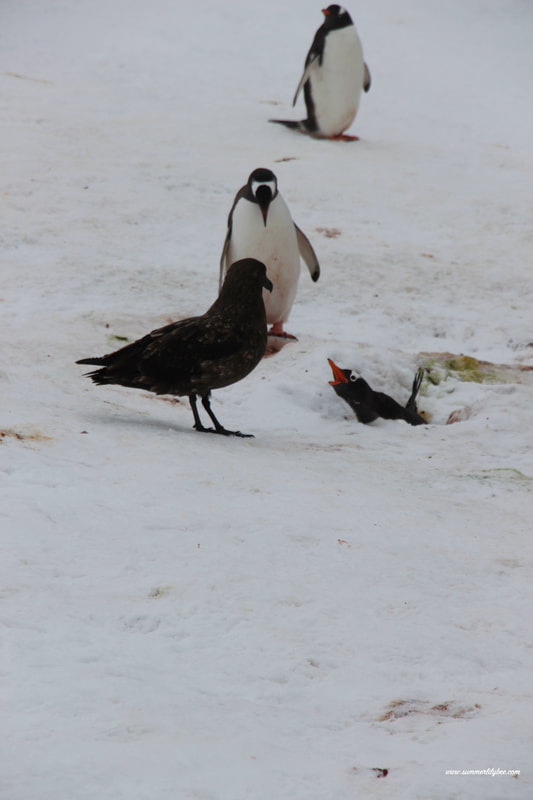
1. Skua fly around trying to approach mother penguin and snatch an egg
|
2. Skua lands near the breeding penguin
|
3. Skua approaching
|
4. Penguin yells at the skua hushing it away
|
|
i remember being speechless after seeing this view from the top
|
and the iceberg… i mean… look at those colors
|
The Cruising
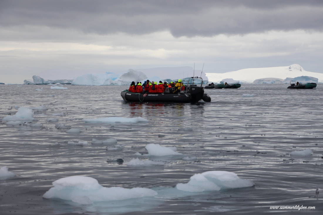
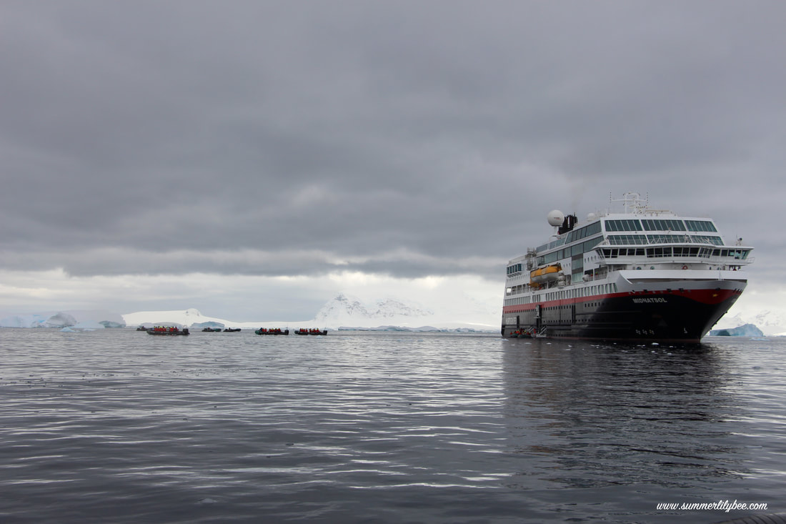
After about 90 minutes wandering the island, i went back and had a nice lunch, before preparing for the cruising. Now, the cruising is basically going around in the icebergs using the rubber boat for about 90 minutes.If I didn’t make it clear before, there are two kinds of activities scheduled for the day. The first one called landing, which is simply walk around the island and do some hikes. The other is cruising. Cruising is basically riding a tender boat and getting around at the sea, viewing some icebergs, growlers, just being at the sea with the tender boat.
Presentation Session
Between lunch and cruising, i went to a presentation session titled “The history of Antarctica” by Tom. This was by far the best Presentation i got so far in the boat. Tom presentation was very fluid and his story telling brought me back to 1800s to the first attempt of finding south pole. There were so many successful and fail expeditions and how each of them played significant role in finding Antarctica we know nowadays. I would love to write all of them here, but of course it will be a very long story I won’t remember the details, but one of the interesting stories i heard about was about the Shackleton Expedition.
If during the landing i could walked and hiked up a bit, getting literally thousands snaps of the penguins, during the cruising i took hundreds snap on the iceberg. I’d say, today activities were perfect in every sense!
Got the ice, got the view, got the perfect Antarctic weather, got the penguins, got everything Antarctica, and we didn’t even land on the main continent yet!!
Where we went yesterday and today were just some small island in the Antarctic Peninsula. And i don’t know when we’re going to land to the “Big Continent”!
Anyway, back to the boat, at 19:30 there’s a session titled “ice, glaciers, ice sheets, icebergs, and sea ice” given by Dom, the geologist, which practically explains about iceberg.
A few facts about Antarctic Ice Sheets
An ice sheet is a chunk of glacier ice that covers the land surrounding it and is greater than 50,000 kilometers (20,000 miles) wide. An ice sheet is also known as a continental glacier. During the last glacial period the Laurentide ice sheet covered much of Canada and North America, the Weichselian ice sheet covered Northern Europe, and the Patagonian ice sheet covered much of Southern South America. Currently, the only ice sheets on Earth are in Antarctica and Greenland.
Ice sheets are usually warmer at their base than on the surface. That is because of geothermal heat. When melting occurs, the water lubricates the sheet and it flows more quickly. This produces fast-flowing channels called ice streams.
The Antarctic ice sheet is the largest single mass of ice on Earth. It covers almost 14 million square kilometers, has 30 million cubic kilometers of ice, and holds approximately 90 percent of the freshwater on our planet. If melted, the Antarctic ice sheet would raise sea levels by 61.1 meters.
The Antarctic ice sheet is divided by the Transantarctic Mountains. On one side is the East Antarctic ice sheet (EAIS), with the West Antarctic ice sheet (WAIS) on the other side of the mountains. Interestingly, the West Antarctic ice sheet lies below sea level, meaning that the WAIS would be seabed if the ice sheet was not there. The WAIS is next to the Ross and Ronne ice shelves.
(source: http://ete.cet.edu/gcc/?/icecaps_icesheets)


